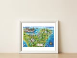
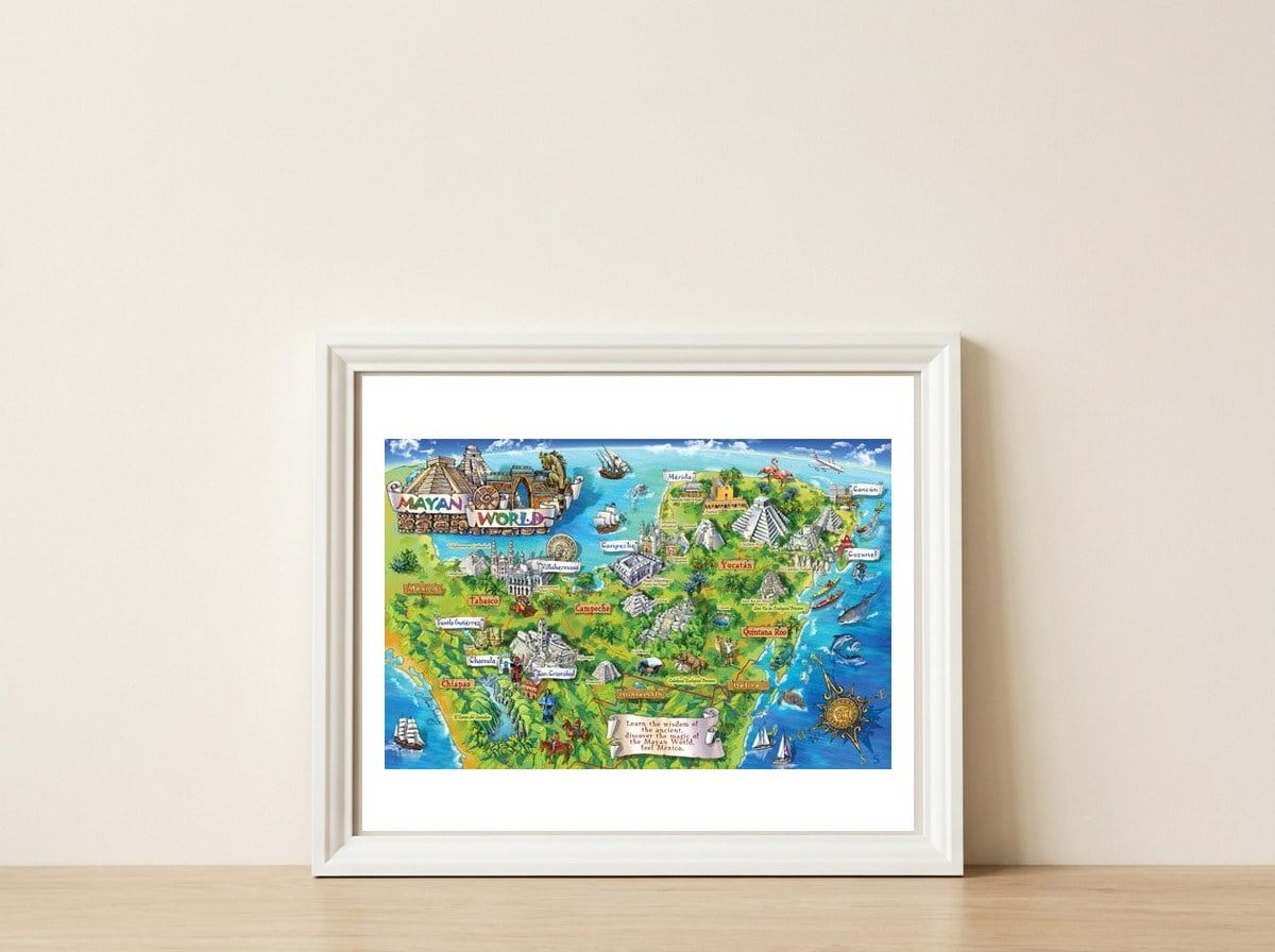
Yucatan Map Illustration
Maria RabinkyMaria Rabinky paints geography as a living narrative, blending cartographic precision with the lush, hand-rendered textures of a traveler's journal. This illustration maps the Yucatan Peninsula as a dense tapestry of jungle canopies and coastal landmarks, inviting a slow exploration of the Mexican landscape.

Yucatan Map Illustration
Maria Rabinky paints geography as a living narrative, blending cartographic precision with the lush, hand-rendered textures of a traveler's journal. This illustration maps the Yucatan Peninsula as a dense tapestry of jungle canopies and coastal landmarks, inviting a slow exploration of the Mexican landscape.
A meaningful share of this purchase goes directly to Maria Rabinky.
Every Arthaus piece supports a living artist.
Art Analysis
Mapping the Verdant Landmarks of the Mexican Coast
In this illustrated map, Rabinky uses a painterly approach to organize the Yucatan’s diverse terrain, highlighting environmental tourism points through detailed iconography. The composition balances the sprawling greenery of the inland forests with the deep blues of the surrounding waters, creating a visual guide that feels both informative and exploratory. By documenting specific natural landmarks, the artwork serves as a bridge between traditional cartography and environmental storytelling.
The piece evokes the spirit of historical charts, framing the peninsula as a site of deep cultural and natural significance. The use of a landscape orientation allows for a wide-angle view of the region, capturing the relationship between the southern border regions and the sea. Each element is rendered with a focus on the region's unique ecological identity, turning a geographic layout into a rich record of place and heritage.
The illustration highlights the lush flora and coastal beauty characteristic of the Yucatan's eco-tourism sites.
The map acknowledges the deep historical roots of the region through its depiction of significant cultural and natural landmarks.
Rabinky employs a landscape orientation to provide a comprehensive overview of the peninsula's physical layout and regional placement.
The work draws on the visual language of historical charts to document the intersection of land and sea.
Free Shipping
On all framed orders
100-Day Guarantee
Love it or return it
Gallery Quality
Museum-grade materials
Artist-Direct
Fair pay, every piece